The sensor-equipped cars drive around the country every day and measure download and upload speed, delay (response time) and map radio frequency coverage (signal strength).
To start your search, click on an area on the map or use the city search and the date filter options.
Search by location and date
Locality:
From (date)?
To (date)?
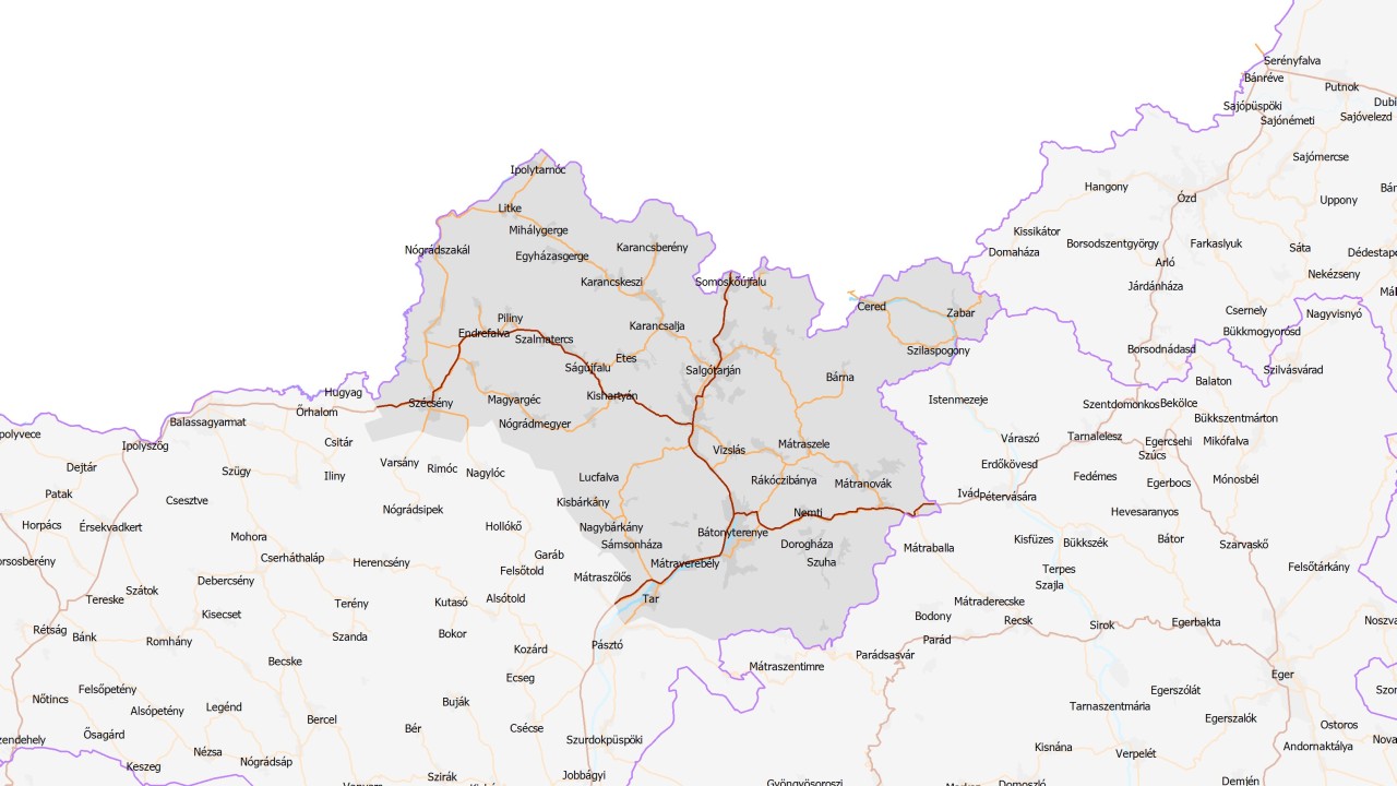
Salgótarján subregion
The subregion settlements:
Salgótarján | Bátonyterenye | Szécsény | Szilaspogony | Karancskeszi | Vizslás | Piliny | Nógrádmegyer | Ságújfalu | Sóshartyán | Etes | Nagybárkány | Karancsalja | Szalmatercs | Bárna | Karancslapujtő | Zabar | Dorogháza | Sámsonháza | Endrefalva | Karancsberény | Kisbárkány | Karancsság | Magyargéc | Nógrádszakál | Nemti | Ludányhalászi | Tar | Szécsényfelfalu | Kishartyán | Cered | Mátranovák | Mátraterenye | Mátraverebély | Márkháza | Szuha | Mátramindszent | Mátraszele | Kazár | Litke | Ipolytarnóc | Egyházasgerge | Mihálygerge | Lucfalva | Nagykeresztúr | Rákóczibánya | Somoskőújfalu |
Salgótarján | Bátonyterenye | Szécsény | Szilaspogony | Karancskeszi | Vizslás | Piliny | Nógrádmegyer | Ságújfalu | Sóshartyán | Etes | Nagybárkány | Karancsalja | Szalmatercs | Bárna | Karancslapujtő | Zabar | Dorogháza | Sámsonháza | Endrefalva | Karancsberény | Kisbárkány | Karancsság | Magyargéc | Nógrádszakál | Nemti | Ludányhalászi | Tar | Szécsényfelfalu | Kishartyán | Cered | Mátranovák | Mátraterenye | Mátraverebély | Márkháza | Szuha | Mátramindszent | Mátraszele | Kazár | Litke | Ipolytarnóc | Egyházasgerge | Mihálygerge | Lucfalva | Nagykeresztúr | Rákóczibánya | Somoskőújfalu |
Latest visit: 2021-07-21
View measurement results on the map: Salgótarján subregion
View measurement results on the map: Salgótarján subregion
As a main rule, our sensor equipped cars revisit each subregion every three months to perform new measurements. Click the text on the map below to enter the page of the measurement results gathered in this subregion.